![101 - [MAP of IRELAND] London Atlas Map of Ireland. By Stanford. Showing provinces, counties, baronies, ci...](https://content.easyliveauction.com/auctions/images_lots/8332BB5E3C4AE3B81E8483AABD015C7A_pur01/1100263373_PREVIEW.JPG)
![101 - [MAP of IRELAND] London Atlas Map of Ireland. By Stanford. Showing provinces, counties, baronies, ci...](https://content.easyliveauction.com/auctions/images_lots/8332BB5E3C4AE3B81E8483AABD015C7A_pur01/1100263369_PREVIEW.JPG)
![101 - [MAP of IRELAND] London Atlas Map of Ireland. By Stanford. Showing provinces, counties, baronies, ci...](https://content.easyliveauction.com/auctions/images_lots/8332BB5E3C4AE3B81E8483AABD015C7A_pur01/1100263372_PREVIEW.JPG)
![101 - [MAP of IRELAND] London Atlas Map of Ireland. By Stanford. Showing provinces, counties, baronies, ci...](https://content.easyliveauction.com/auctions/images_lots/8332BB5E3C4AE3B81E8483AABD015C7A_pur01/1100263370_PREVIEW.JPG)
![101 - [MAP of IRELAND] London Atlas Map of Ireland. By Stanford. Showing provinces, counties, baronies, ci...](https://content.easyliveauction.com/auctions/images_lots/8332BB5E3C4AE3B81E8483AABD015C7A_pur01/1100263371_PREVIEW.JPG)
€25
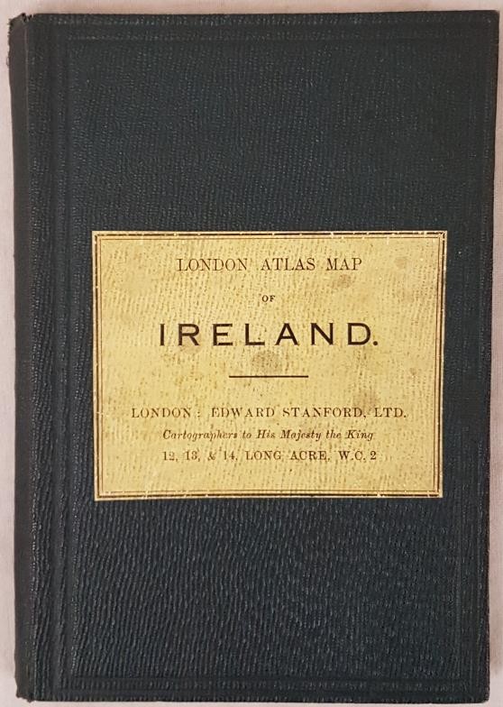
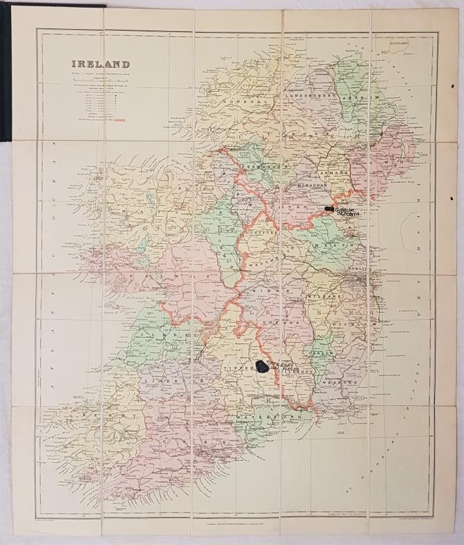
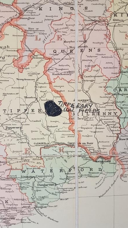
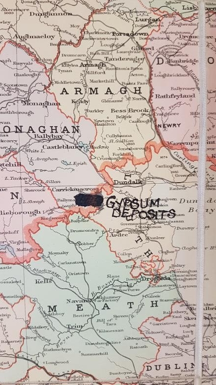
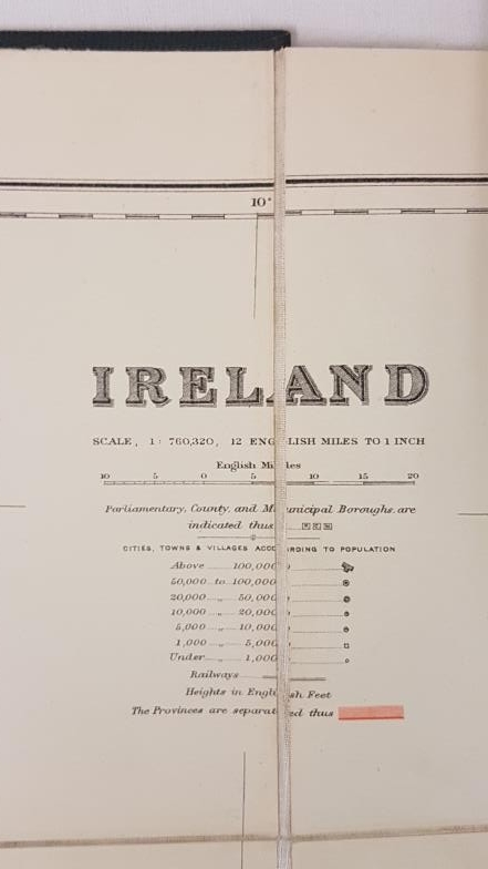
[MAP of IRELAND] London Atlas Map of Ireland. By Stanford. Showing provinces, counties, baronies, cities & towns, railways, stations, canals, mountains, rivers, bays, heads, etc. Scale: 12 English miles to 1 inch. Coloured. London: Edward Stanford Ltd., n.d. 56 x 66cm. Folded, linen-backed, in cloth binder, printed label on upper cover. Fine. Gypsum deposits marked in ink on Monaghan / Louth border and coal deposits in ink in County Tipperary. Owner's signature on verso of map
Fees apply to the hammer price:
Online Bidding:
28.29% inc VAT*